Photographs
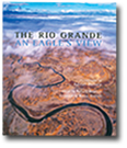
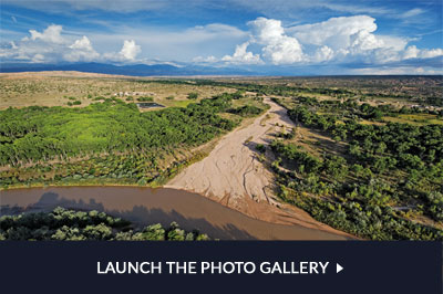
The Rio Grande: An Eagle’s View features 185 different photographs representing the entire length of the river, nearly 1,900 miles. A quick calculation shows that this is about one image for every ten miles of river. We didn’t plan it that way, and the coverage certainly isn’t that systematic, but we did try to balance the representation geographically as well as thematically. We had a rich trove of images to choose from; by the time I made the most recent image in the book, I had amassed some 35,000 photographs of the Rio Grande.
When I began photographing the river in January 2001, I had no idea the endeavor would turn into a ten-year quest. A decade brings profound change: the project’s scope evolved from the upper river to the entire river; new donors stepped forward to support the expanded coverage; the book team coalesced; publishing plans clarified; contributors committed–and the river continued to flow under mounting stress.
My own life had its cascade of changes too: my father passed away suddenly soon after I began photographing the river; our children grew into young adults and left home, my wife and I moved three times, my original homebuilt airplane was retired as I transitioned into a new high-tech aircraft, and I turned from film to digital capture.
From 2001 until 2008, I photographed exclusively on color transparency film in the 6x4.5 cm format using Pentax equipment. Then, because of the unique demands of another project I was working on, I acquired a Nikon D3 system and soon began using it on the river as well. Although the amount of detail in my images took a hit (medium format film scanned at high resolution still exceeds the resolving power of even the best digital SLR cameras), I realized several advantages from the switch to digital.
One was the ability to shoot in extremely low light. As I worked from the air at the margins of the day, this low digital noise / high light sensitivity feature of the D3 made a difference in the kinds of images I could produce. For examples, see the photographs on pages 148-149, 164-165, 170, and 171. Also helpful were the workflow improvements; the time and hassle of changing film in the air became a memory, and metadata for each image were precise, abundant, and easily managed. For example, every shot I made was tagged with the latitude, longitude, and altitude of the camera at the moment of capture.
The title makes it clear that all the photographs in the book are aerials, a fact that deserves brief comment here. As a photographer, I specialize in aerials. I have invested much time, effort, and expense in cultivating my ability to shoot in the air, and to do it with the utmost technical quality. The impetus for this pursuit is my love for flying, for seeing the earth from above, and for making images out of that experience. Given this passion, the wealth of subject matter, and the time limit of my life span, I years ago decided to focus my professional efforts on work in the sky.
John Horning knew this when he approached me about photographing the Rio Grande, and indeed there is much to commend the aerial treatment in portraying a river system. Vast geographic extent, diverse landscapes, and relentless seaward flow are all features of a river that aerial photographs can evoke especially well. And the reader is served by the view from above because it offers a unifying vision of an otherwise endless barrage of locations and details. Other photographic books have taken on the entire Rio Grande–Laura Gilpin’s The Rio Grande: River of Destiny and Jim Bones’ Rio Grande Mountains to the Sea: Photographs are both classics. But An Eagle’s View is the first to bring the magic and power of aerials to bear on the Great River, and in doing so satisfy the journeyer’s overarching yen for context.
Now to the practicalities: How can I fly the plane and shoot at the same time? Why don’t I have someone else fly while I shoot? How do I make such sharp images while hand-holding the camera and moving through space? How do I know where I am and what I’m shooting?
Certain characteristics of my airplane are the key to how I work; they are true of both my original homebuilt plane and its successor. The aircraft is very light and therefore capable of flying very slowly (750 pounds, 35 to 45 mph). Because of this, it is feasible to fly quite low and still have an acceptable margin of safety. As you might imagine, the resulting view is nothing less than spectacular. I slowly circle the subject I'm working, which gives me time to study and think about what I'm seeing. This leads to ideas for images, and then I have the luxury of composing my photographs with precision.
How do I fly the plane while doing this? First, the plane is quite stable on its own, and things like throttle and trim settings (fine adjustments to the controls) can be fixed for sustained operation without constant attention. Second, I strap the control stick to my right knee and maneuver the plane simply by moving my leg around, thereby freeing up both my hands for holding and aiming the camera. (I compose with the camera viewfinder at my eye just the way you would walking around on the ground–no remote mounts, controls, or monitors.) Third, all my senses are keenly tuned to my environment, and although I may have one eye behind the viewfinder, I maintain full kinesthetic situational awareness. As a professional pilot with over 12,000 hours of flight time, with several thousand of those spent making photographs in the air, minding the airplane while I work with the camera comes quite naturally.
The idea of benefiting from someone else flying the plane while I shoot is contrary to my actual experience. As it is, I feel at one with the aircraft, and can intuitively steer it to where I need to be in three dimensions without conscious thought, let alone verbalizing my intentions to another person. My work arises from the power and freedom afforded by this fusion of human and machine. Beauty and mystery are my motivation for perfecting it.
One essential piece of equipment is my gyrostabilizer. You might think of it as the aerial photographer's substitute for a tripod, although it doesn't support the camera the way a tripod does; it must be lifted and held along with the camera itself. Altogether the package is a heavy handful, which is why I need both hands free to shoot. But its function is to dampen any motions of the camera that are not deliberate using gyroscopic inertia, and in the hands of an experienced operator, it can lead to surprising results. For example, the photos on pages 170 and 171 were taken from a moving airplane, holding the camera in my hands, late at night, with only the city lights for illumination...and they are sharp.
Most parts of the Rio Grande I visited for the first time by finding them in flight after hours of studying maps and books: maps, to familiarize myself with local topography, and books, to educate myself about what I would be seeing. Because my style of flying is low, slow, and open, it is intensely kinetic and visual, and because I must navigate from the known into the unknown or unfamiliar, I build a body- and sight-memory of every landscape I’ve flown and photographed. Although I have a Global Positioning System unit with a detailed topographic database in my airplane, no GPS database is more infused with meaning than the lifetime mental model taking shape within me from all my aerial explorations.
And post-flight research is no less vital than study beforehand. Much of the impact of any given flight comes from the personal discovery of unexpected scenes. Using the force of fresh curiosity to investigate the stories behind what I have seen produces a deeply rooted sense of familiarity and comprehension. Subsequent visits (I’ve flown and photographed the whole river multiple times) have the flavor of renewed friendships holding the promise of going deeper than ever before.
Because learning to know the river is a never-ending process, because the river itself is never the same, and because I love this work, I expect to be photographing the Rio Grande the rest of my flying days.
© 2012 Adriel Heisey
For more on Adriel’s work, visit his web site: www.adrielheisey.com


